|
|
Post by raymond on Mar 28, 2007 19:52:49 GMT -5
Cheryl,
Sorry for the confusion in terminology regarding the Shiqi River. In order to garner an overall appreciation of this topic, one should understand that the Pearl River Delta in Guangdong Province is part of an estuary, which in technical terms, an estuary is a semi-enclosed coastal body of water with one or more rivers or streams flowing into it, and with a free connection to the open sea (from wikipedia.com). The Pearl River estuary receives water from the West, North and East Rivers, and there are more than 200 waterways in the delta area. The water in these waterways flows in different directions, thus forming a highly complex river network. These waterways ultimately empty into the South China Sea. As twoupman has so aptly pointed out, the Shiqi River is one of these waterways that flow through Shekki (now called Zhongshan City), and it is not part of the Pearl River that runs through Guangzhou. While the Shiqi River is not technically a tributary to the Pearl River itself, it is an integral part of what is called the Pearl River waterway system. Thus, the Shiqi River is a separate waterway.
This explanation is a bit technical, but I hope this clarifies the genesis of the Shiqi River for you. Take a look at a map of the Pearl River Delta for additional clarity.
Raymond
|
|
|
|
Post by Henry on Mar 28, 2007 20:40:22 GMT -5
Dear Colleagues, I thought you may find the following historical maps of the Pearl River Delta - interesting. They appeared in the article " People Said Extinction Was Not Possible;" 2000 Years of Environmental Change in South China by Professor Robert B. Marks. I believe "Xiangshan" was a former name for Zhongshan. Enjoy ! Henry ![]() mysite.verizon.net/vzepzaui/Delta mysite.verizon.net/vzepzaui/Delta - Historical.jpg[/img] |
|
|
|
Post by cheryl on Mar 29, 2007 0:15:28 GMT -5
Dear Raymond,
Thanks. I'll give it a try now that I have the current names.
Cheryl
|
|
|
|
Post by cheryl on Mar 29, 2007 0:18:23 GMT -5
Oops, my last reply should have been to twoupman for an earlier reply. Sorry for the confusion.
Thanks. I'll give it a try now that I have the current names.
Cheryl
|
|
|
|
Post by cheryl on Mar 29, 2007 0:24:06 GMT -5
Dear Raymond and Henry,
Thanks for the information about the Pearl River system and the maps. I am learning quite a bit about the area and how the rivers flow to the surrounding villages. Henry, am I correct in assuming that the bottom right map is the most current?
Cheryl
|
|
|
|
Post by Henry on Mar 29, 2007 8:36:04 GMT -5
Hi Cheryl,
Yes, the bottom right map was the latest of the 4 maps. The "CE" acronym/abbreviation may be confusing - so, I found a short explanation from the Internet:
"CE stands for "Common Era." It is a relatively new term that is experiencing increased usage and is expected to eventually replace AD. The latter is an abbreviation for "Anno Domini" in Latin or "the year of the Lord" in English. The latter refers to the approximate birth year of Yeshua of Nazareth (a.k.a. Jesus Christ). CE and AD have the same and value. 2004 CE = 2004 AD.
BCE stands for "Before the common era." It is expected to eventually replace BC, which means "Before Christ," or "Before the Messiah." BC and BCE are also identical in value."
These historical maps are interesting because they portray the development and growth of the Pearl River Delta over time - which in part explains why many of the cities and towns in the Pearl River Delta might only appear on current maps and not on historical maps.
Henry
|
|
|
|
Post by Henry on Apr 10, 2007 17:03:36 GMT -5
Hi Cheryl,
I think I have found your ancestral village "An Hang". Please look in the NW quadrant of the map and you'll see the arrow pointing to the village just beneath the road marker " G105" This is an August 2005 map and I believe it is the latest map commercially available.
Can one of our Chinese literate colleagues confirm the Chinese characters for "An Hang". I know the first character, but, I do not know the second character and also, I believe it is in simplified Chinese.
Henry
PS - I have removed the map since the village that I identified is not your ancestral village An Hang.
|
|
|
|
Post by twoupman on Apr 10, 2007 21:38:09 GMT -5
Henry,
It is not An Hang (what dialect?) but Anle (安樂 in Traditional characters) which means peace and happiness.
|
|
|
|
Post by Henry on Apr 10, 2007 22:01:56 GMT -5
Cheryl,
Sorry - please see if you can provide the Chinese characters for An Hang. Thanks Al.
Henry
|
|
|
|
Post by tyuti1668 on Jul 22, 2007 17:04:14 GMT -5
Asked some old fellowes: "Ah Hang" in dialect = Today's "下澤" 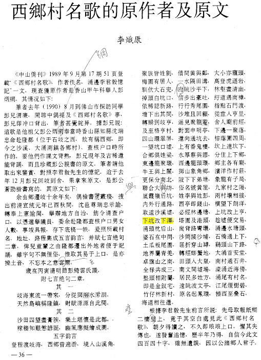 |
|
|
|
Post by mugenpower168 on Jul 13, 2010 3:16:27 GMT -5
Which other villages east of the river speak Longdu dialect? the "outlying" Longdu speaking area: 南区 : 月山 寮后 金溪 沙田 树涌 坦背 : 观栏 板芙 : around 里溪/深湾 神灣 : 芒冲 Similar dialect also in 唐家 淇澳岛 Hi tyuti1668, This post was originally posted in Douglas' "My Excellent Adventures in China" thread but I do not want to add irrelevant posts to it so I thought it would be more appropriate to post here. I want to ask if 月山, 金溪, 樹涌, 觀欄, 里溪 and 芒沖 had former names because I can't seem to find these villages in this database. www.c-c-c.org/villagedb/search.cgi |
|
|
|
Post by tyuti1668 on Jul 13, 2010 4:57:03 GMT -5
C-C-C db records some village ONLY. Complete record pls refer to libary's 香山縣志. www.zsda.gov.cn/html/zsdq/zszs/xz/the å—å€ is area 1 -http://www.c-c-c.org/villagedb/display.cgi?level=Heung&id=372 - ä¸å±±å¸‚地åå¿— www.zsda.gov.cn/uploads/book/zhuanyezhi/dimingzhi/18.htmç¦æ¶Œæ‘民委员会(FúchÅng CÅ«nmÃn WÄ›iyuánhuì)...   月山(YuèshÄn)在环城区... 寮åŽæ‘民委员会(Liáohòu CÅ«nmÃn WÄ›iyuánhuì)辖1个自然æ‘(详è§â€œå¯®åŽâ€é‡Šæ–‡ï¼‰ã€‚   寮åŽ(liáohòu)在市政府... 金溪æ‘民委员会(JÄ«nxÄ« CÅ«nmÃn WÄ›iyuánhuì)辖1个自然æ‘(详è§â€œé‡‘溪â€é‡Šæ–‡ï¼‰ã€‚   金溪(JÄ«nxī)在市政府... 沙田æ‘民委员会(ShÄtián CÅ«nmÃn WÄ›iyuánhuì)在市政府...   沙田(ShÄtián)在市政府... æ ‘æ¶Œæ‘民委员会(ShùchÅng CÅ«nmÃn WÄ›iyuánhuì)辖1个自然æ‘(详è§â€œæ ‘涌â€é‡Šæ–‡ï¼‰ã€‚ ã€€ã€€æ ‘æ¶Œï¼ˆShùchÅng)在市政府... www.zsda.gov.cn/uploads/book/zhuanyezhi/dimingzhi/27.htm里溪æ‘民委员会(LÇxÄ« CÅ«nmÃn WÄ›iyuánhuì)在石å²...   里溪(LÇxī)在石å²... 深湾æ‘民委员会(ShÄ“nwÄn CÅ«nmÃn WÄ›iyuánhuì)在石å²...   边涌(BiÄnchÅng)在æ¿èŠ™é•‡æ”¿åºœä¸œå—5.2公里处。属深湾æ‘委会... www.zsda.gov.cn/uploads/book/zhuanyezhi/dimingzhi/index.htm观æ æ‘民委员会(GuÄnlán CÅ«nmÃn WÄ›iyuánhuì)在石å²...   厚丰(HòufÄ“ng)在å¦èƒŒé•‡æ”¿åºœå—... www.zsda.gov.cn/uploads/book/zhuanyezhi/dimingzhi/index.htm芒涌æ‘民委员会(MÄngchÅng CÅ«nmÃn WÄ›iyuánhuì)辖1个自然æ‘(详è§â€œèŠ’涌â€é‡Šæ–‡ï¼‰ã€‚   芒涌(MÄngchÅng)在石å²... |
|
|
|
Post by mugenpower168 on Jul 13, 2010 20:58:03 GMT -5
Thanks for the links, they are very informative. I would like to know exactly where the historic district of Longdu encompasses. Nearly all articles I have read say that it is the present day Dachong and Shaxi. However, from this article www.zs.gov.cn/main/about/infoview/index.action?id=41789 it says that 隆鎮/ç¬¬äºŒå€ covers the present day "沙溪ã€å¤§æ¶Œã€æ©«æ¬„ã€æ²™æœ—å’Œæ¿èŽ¢(I think this is supposed to be æ¿èŠ™)西部一帶," thus indicating that Longdu covered an area beyond just Dachong and Shaxi. My questions are: 1. Which villages of 橫欄 and æ¿èŠ™ are part of the historic district of Longdu? 2. Are there any other areas that were once part of Longdu that the article neglects to mention? |
|
|
|
Post by tyuti1668 on Jul 13, 2010 22:07:31 GMT -5
Those non- 沙溪ã€å¤§æ¶Œ area are alluvial field (沙田). The resdientis are Yue speaker (å—ç•ªé † immgrant) that rents land. In past we called them "蜑家佬". When communist tooks power, they ruined Longdu speaker's benefit.
--
Zhongshan Outlaws in ROC (http://www.zsnews.cn/ZT/ZSZX/showindex_1188.shtml) had many stories releated to thoese "profitable" area .
|
|
|
|
Post by mugenpower168 on Jul 13, 2010 22:58:48 GMT -5
I see, so although there were areas outside Dachong/Shaxi that were administratively part of Longdu, only Dachong/Shaxi (and to an extent some of the outlying villages previously mentioned) are culturally/linguistically considered Longdu. Is this correct?
|
|


